


Interactive map shows campus layout changes
February 8, 2018
University faculty members have teamed up to develop “Mapping History at Illinois,” an online project using interactive maps to show changes in the University’s layout, that is now available to students.
“Mapping History at Illinois” is intended to be a website people can use for years, said James Whitacre, geographic information system specialist for the project.
“A story map is like a mini web application that brings in maps and other media, like images, videos and other webpages, in a narrative structure that gives geographic context to a story,” Whitacre said.
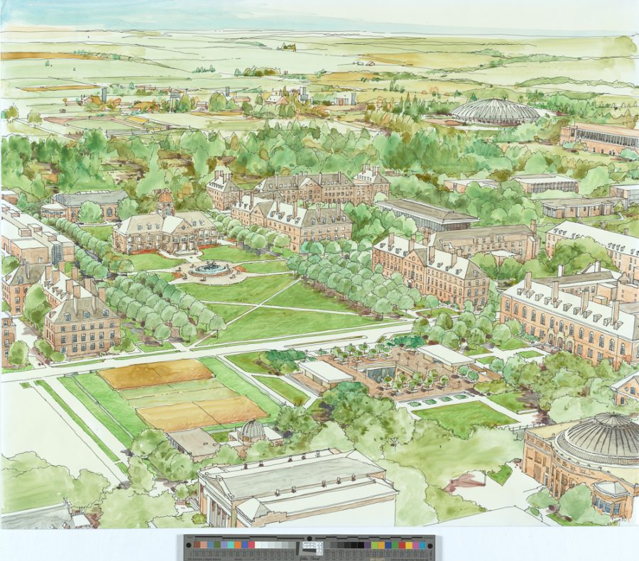
There was no official plan for the University’s architecture or campus layout for decades after its founding in 1867.
In “An Illini Place,” a book about building the campus by professor Lex Tate and writer and archivist John Franch, Stanley Ikenberry said the University has had more than its share of inconsistencies in building planning.
Get The Daily Illini in your inbox!
“While every university campus has some variety in its architectural style, the Urbana-Champaign campus during the 1950s, 1960s and 1970s had no unifying theme or character,” Ikenberry said in the foreword of “An Illini Place.”
The University was made possible by the Morrill Act of 1862, signed by President Abraham Lincoln to incentivize the building of universities.
The University began as a few acres on the site of the Beckman Institute, and University officials at the time did not give much thought to campus planning, according to Franch. It was not until the Blackall Plan of 1906 that the University began to become organized in a rational way.
“From the beginning, the University had a lot of land. Space wasn’t at a premium, so University officials could locate buildings wherever they wanted for whatever reason,” Franch said in an email. “The Blackall Plan kicked off a century-plus of U of I campus planning and established the framework for all future campus plans.”
The Engineering campus has gone from a cluttered location to an impressive destination spot. Green Street has also gone from being a run-down street for local businesses to a vibrant college community with high-rises and upscale shops, he said.
“Green Street also has undergone a massive facelift. It has a different look and feel to it, to say the least,” Franch said.
As the University has grown, so too has the student population. However, it is difficult to determine where students lived on campus prior to the establishment of residential buildings such as Busey Hall, the first dormitory.
“There was a very strong sorority and fraternity presence very, very early on and that’s where a lot of students lived, so early residence information is not as prevalent,” Whitacre said.
The University is an additive campus, meaning it has grown over time to meet demands; there haven’t been many buildings demolished and replaced, he said. The Main Library especially, with its growth accommodating a rising collection, is an example of what it means to be an additive building.
“Just simply by looking at this you can get an idea of how the buildings have expanded on campus; the main library is one of the most additive buildings on campus,” Whitacre said. “If you look at the histories, you can learn all sorts of stuff.”