


The National Weather Service announced Tuesday the possibility of severe weather in Central Illinois beginning around 3 p.m.
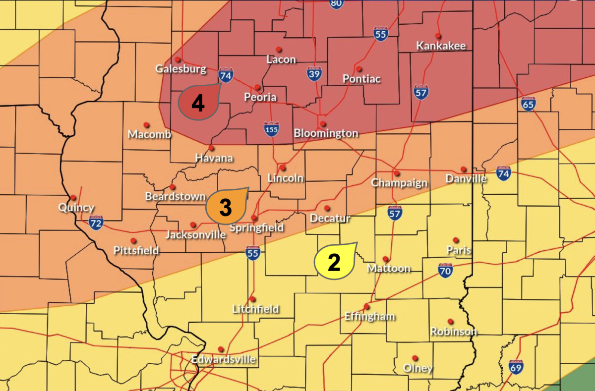
According to the NWS, Champaign County is now at a level three out five on the Enhanced Risk scale for severe weather Tuesday afternoon. Several hazards are possible, including tornadoes, supercells, localized flooding, large hail and damaging winds.
Illinois Public Media Meteorologist Andrew Pritchard wrote in a social media post Monday evening that the highest risk for storms is between 5 p.m. and midnight. The outlet reported rain and thunderstorms will continue into Wednesday morning.
Jeffery Frame, a meteorology professor in LAS, posted on X Monday evening that predictive models indicate Tuesday’s storm will likely form north of Champaign-Urbana. He said this is still a possibility, but a tornado watch is now likely.
“It still looks like the bulk of the severe storms remain north of Champaign-Urbana this afternoon, but they may be just close enough that we’re included in a tornado watch at some point,” Frame wrote.
Get The Daily Illini in your inbox!
The NWS advises people to have multiple ways to receive weather alerts and be prepared to take shelter when storms develop. When warnings are sent, the service advises going to the lowest level of a building or to an interior room with no windows.
**This is a developing story. The Daily Illini will update as more information becomes available.**