Facebook
Instagram
X
Tiktok
YouTube
The Daily Illini
Search this site
Submit Search
The Daily Illini
News
University
Around Campus
C-U
Around the World
Longform
Sports
Men’s Sports
Baseball
Men’s Basketball
Cross Country
Football
Golf
Men’s Gymnastics
Tennis
Men’s Track & Field
Wrestling
Women’s Sports
Women’s Basketball
Cross Country
Golf
Gymnastics
Soccer
Softball
Swim & Dive
Tennis
Women’s Track & Field
Volleyball
Columns
Club Sports
Hockey
Wheelchair Basketball
Podcasts
Features
Education & Campus Life
Around Town
Culture & Diversity
Business, Tech & Science
Arts & Entertainment
buzz
Best of CU
Community
Music
Columns
Featured Flicks
Music Reviews
Food Reviews
Book Reviews
Game Reviews
Festival Coverage
Pygmalion
Lollapalooza
Opinions
Columns
Politics
Culture
World
Health
Business & Tech
Campus Scout
Editorials
Perspectives
Letters to the Editor
Photo
Galleries
ILLordle
Salary Guide
CU Faith & Life
Housing
Time Machine
Hall of Fame
Special Sections
Moms Weekend
Dads Weekend
New Student Edition
International Student Guide
Humans of C-U
Housing Guide
Technograph
I on Illini
Black History Month
Graduation Guide
Wellness Edition
Sex and Dating Guide
LGBTQ Edition
Asian Heritage Edition
Sustainability Edition
Submit a Tip
More
Menu
The Daily Illini
🗞️ print
📣 news
Longform
🌺 life and culture
💬 opinions
🏅 sports
🎵 buzz
📸 photo
🔅 CU Faith & Life
🏡 housing
💸 salary guide
✨ special sections
💌 subscribe
Newsletter
Press Box
Instagram
Facebook
Twitter
Paper
❓ about
Advertise
Archives
Apply
Contact us
Corrections Policy
Ethics Code
Submit a Tip
Staff
Terms of Use
🎨 Illini Media Company
Donate
WPGU 107.1
Illio Yearbook
More
The Daily Illini
Open Search Bar
Search this site
Submit Search
Menu
News
University
Around Campus
C-U
Around the World
Longform
Sports
Men’s Sports
Baseball
Men’s Basketball
Cross Country
Football
Golf
Men’s Gymnastics
Tennis
Men’s Track & Field
Wrestling
Women’s Sports
Women’s Basketball
Cross Country
Golf
Gymnastics
Soccer
Softball
Swim & Dive
Tennis
Women’s Track & Field
Volleyball
Columns
Club Sports
Hockey
Wheelchair Basketball
Podcasts
Features
Education & Campus Life
Around Town
Culture & Diversity
Business, Tech & Science
Arts & Entertainment
buzz
Best of CU
Community
Music
Columns
Featured Flicks
Music Reviews
Food Reviews
Book Reviews
Game Reviews
Festival Coverage
Pygmalion
Lollapalooza
Opinions
Columns
Politics
Culture
World
Health
Business & Tech
Campus Scout
Editorials
Perspectives
Letters to the Editor
Photo
Galleries
ILLordle
Salary Guide
CU Faith & Life
Housing
Time Machine
Hall of Fame
Special Sections
Moms Weekend
Dads Weekend
New Student Edition
International Student Guide
Humans of C-U
Housing Guide
Technograph
I on Illini
Black History Month
Graduation Guide
Wellness Edition
Sex and Dating Guide
LGBTQ Edition
Asian Heritage Edition
Sustainability Edition
Submit a Tip
More
The Daily Illini
Open Search Bar
Search this site
Submit Search
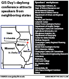
Illinois celebrates modern mapmaking with International GIS Day
November 19, 2014
Close
Close Modal Window
Close